Friday 23 February 2018

Black Hill (Lanark) collecting Boghill, Gallow Hill, Nemphler Moor and Hill of Maudslie along the way

20 February 2018
 
Participants: Neil and Ben
Where: Black Hill (Lanark), 290m/951' P51, Tump, OS 72, NS 832436; Boghill, 257m/843', P31, Tump, OS 72, NS 829 398: Gallow Hill, 247m/810', P39, Tump, OS 72, NS 889 442; Nemphlar Moor, 204m/669', P77, Tump, OS 72, NS 853 451; and Hill of Maudslie, 204m/669', P47, Tump, OS 72, NS 821 515.
 
Black Hill to the west of Lanark had been recommended to me by Alex and Bob of Blue Sky Scotland blog and that was the focus of the day. I worked out that by driving down the M74 and coming back by the A73 I could take in 4 more Tumps along the way with next to no effort, as will be explained.
 
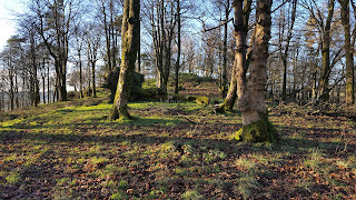
The first stop was just past Lesmahgow to "climb" Boghill, I parked at a radio mast, crossed the road, went through a gate and over some rough pasture for a couple of minutes and I was there. About 5m of ascent I reckon. There were a lot of new plantings so the view was pretty restricted.....


Carrying on on the same road, it was only a few miles to the starting point for Black Hill. There was space for a few cars at the start of the hill which is NTS owned. The hill is a strategic viewpoint overlooking the Clyde valley. A Bronze Age cairn and an Iron Age settlement have been discovered here. Archaeological excavations took place during 2017 and more are planned in 2018.

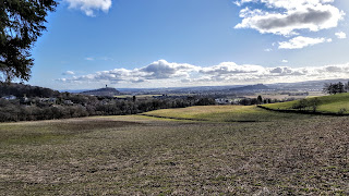
It certainly was a great viewpoint. Ben waits to be let into the second of two fields to be crossed with the trig appearing ahead.....


A fine view of Lanark from part way up.....


The trig and a view over Lanark to (I think) the hills around Broughton.....


Looking north to the Glasgow/Motherwell/Hamilton area.....


Tinto- some say that our ancestors aligned their cairn on Black Hill with that on Tinto, who knows?


A couple of photos looking to the west......


This is a hill that I would be happy to revisit.

I then drove to Lanark for a walk round Lanark Loch, always a popular and pleasant way to spend a spare hour. And then it was time to head home and to demonstrate the absurdity, but fun, of Tump bagging. Gallow Hill in Lanark itself was probably nicely wooded at one time, but today has been built on. The highest point is in front of some houses.....


Nemphlar Moor is crossed by a road and the highest point is in the middle of a field- a little walking required here and a fine view of Tinto.....


Finally, back to the drive by. Hill of Maudslie in the village of Law has also been built on. The trig has been replaced by someone's house. All I had to do here to gain the tick was to step out of the car and then step back in.....


All quaintly enjoyable with Black Hill outstanding.

Wednesday 21 February 2018

Some more Tumps: Fir Hill (Aberfoyle): Dunwan (Whitelee): Gallow Hill (Bridge of Allan):Eastcraigs Hill (Blackridge); Tormain (Ratho); Grayrigg (Avonbridge)

2 February 2018

Participants: Neil and Ben
Where: Fir Hill, 78m/256' P59, OS 57, NS 537 970
 
Fir Hill is a small wooded hill south of Aberfoyle off the Glasgow road. There seemed to be no objection to parking in the Trossachs Holiday Park site beside a dog walking area from where a path led almost to the summit. Best of what views there were was of the Craig of Monievreckie to the north; looking to the west through the branches I could also see Ben Lomond......


5 February 2018

Participants: Neil and Ben
Where: Dunwan (Whitelee), 300m/984', P33, OS 64, NS 547 489

Back to Whitelee to bag the Tump I missed out (due to an excess of sheep) on my last visit. On this occasion, we just made it, the farmer was gathering up his sheep from the moor and looking back after we'd climbed it, we saw that he was leaving them in the pasture around the hill! This is the best of the Whitelee Tumps, a very distinctive hill which apparently had an Iron Age fort on top. Some photos.....


9 February 2018

Participants: Just me
Where: Gallow Hill (Bridge of Allan), 110m/361' P43, OS 57, NS 783 987

I used public transport for this one- the train to Bridge of Allan. The path to the hill started opposite the station......


The best of the views were towards Abbey Craig and the Wallace Monument and to Stirling castle......


The highest point was a boulder in the trees with a view through the foliage to Dumyat.....


16 February 2018

Participants: Neil and Ben
Where: Eastcraigs Hill (Blackridge) 250m/820', P43m, OS 65, NS 903 680; Tormain (Ratho) 147m/482', P39, OS 65, NT 129 697; and Grayrigg, 210m/689', P49m, OS 65, NS 909 767

Off to West Lothian on a bright day but with a strong, cold wind. From the A89 in Blackridge, I followed Heights Road to get to the north of Eastcraigs Hill. It was a bit muddy but only a short walk to the broken down trig and the summit boulder. There was a fine view to the Bathgate Hills.


I next drove to Ratho for Tormain, a very pleasant woodland walk to the west of the village. This was obviously the place that Ratho dogs go for their walks; we met lots of furry friends. The highest point was a mound with a couple of cup and ring marked stones. There were fine views of Edinburgh and of the Pentlands Hills from the edge of the woods with viewfinders to help with the identification of the distant hills.


I drove home by Avonbridge to tick off Grayrigg. The questions for this Tump must be "why" and "who finds these things"? It was a drive by as the B8028 runs within yards of the highest point which is next to the wall of a barn. I did jump the gate and go to it. A few minutes for this one!


Friday 2 February 2018

A temple on a hill: Kenmuir Hill plus Law Hill

1 February 2018

Participants: Neil and Ben
Where: Kenmuir Hill, 77m/253', P35, Tump, OS 63, NS 387 606 and Law Hill, 85m/279', P33, Tump, OS 63, NS 385 666
 
I had often wondered, when driving along the A737 to the coast, what the octagonal shaped tower was on the top of the hill just before Lochwinnoch. I found out that the hill, Kenmuir Hill, was a Tump so there was an extra incentive to go and have a look.
 
It was a beautiful sunny day so I decided to take the long route and walk along the old railway track, now a walking and cycling route, from Castle Semple visitor centre. The loch here is very pleasant, this is a photo of it from near the visitor centre with the tower away in the distance.....
 
 
Ben on the track....
 
 
This area used to be Clan Semple land.  Castle Semple house has now gone but the ruins of the Collegiate Church can still be visited, just off the track. We walked about 2 miles before the tower came into view......
 
 
Unfortunately, a herd of sheep also came into view, grazing peacefully around the tower and I decided that rather than be dragged around the hill by an excited spaniel, I would put plan B into action, an approach from the Howwood side. It was a shorter walk from there and Ben could stay in the car. So we retraced our steps to the visitor centre, had a look around, wandered along the shore for a bit and then set off for Howwood, where there was a parking area beside the bridge over the river. I cut up across a couple of very wet fields to the east top of Kenmuir Hill which was also the highest point of the hill. There was a fine view from here towards Glasgow with the snow covered Campsie Fells beyond.....
 
 
The tower was only a short step from here.....
 
 
Apparently the tower, built around 1760, served no useful purpose. It was built as a landscape feature for people to see- a folly. It is referred to as Semple temple although there is no indication that it ever had anything to do with religion. Still, an interesting shape and building although most of the inside features and the roof are now gone.....


As I expected, there was a fine view down Castle Semple loch.....
 
 
Rather than face the late afternoon traffic congestion on the Kingston bridge, I headed for the Erskine bridge, going via Kilbarchan and Bridge of Weir. The Council must have run out of money, the potholes hereabouts were the worst that I have seen. There was of course an ulterior motive in going this way; there was another Tump, Law Hill, just outside Bridge of Weir which I could bag on the way. It turned out to be a short walk through pleasant woodland, with a reasonable view towards the city from the adjacent field.....


Another pleasant and interesting day trip.